Continuous monitoring of the salt front in a river downstream of a drinking water pumping station and early warnings
Customer needs
Customer issues
Our client is an EPTB (Etablissement Public Territorial de Bassin) in western France, working for the sustainable management of water, rivers and aquatic environments. Downstream of the basin, a dam on the estuary is used to manage water levels in the basin and a freshwater reserve supplies the largest drinking water production unit in the region.
This reserve is used for a variety of purposes and can give rise to complex conflicts, particularly during periods of drought. The dam is equipped with a lock, leading to seawater intrusions during lockage periods. During low-water periods, a fraction of the salt water can rise into the water body and degrade the quality of the water at the plant’s water intake. With climate change, periods of drought and conflicts of use could become more intense.
We were tasked with monitoring the intrusion of seawater into the river during lockage and tracking its spread to the pumping station’s drinking water intake.
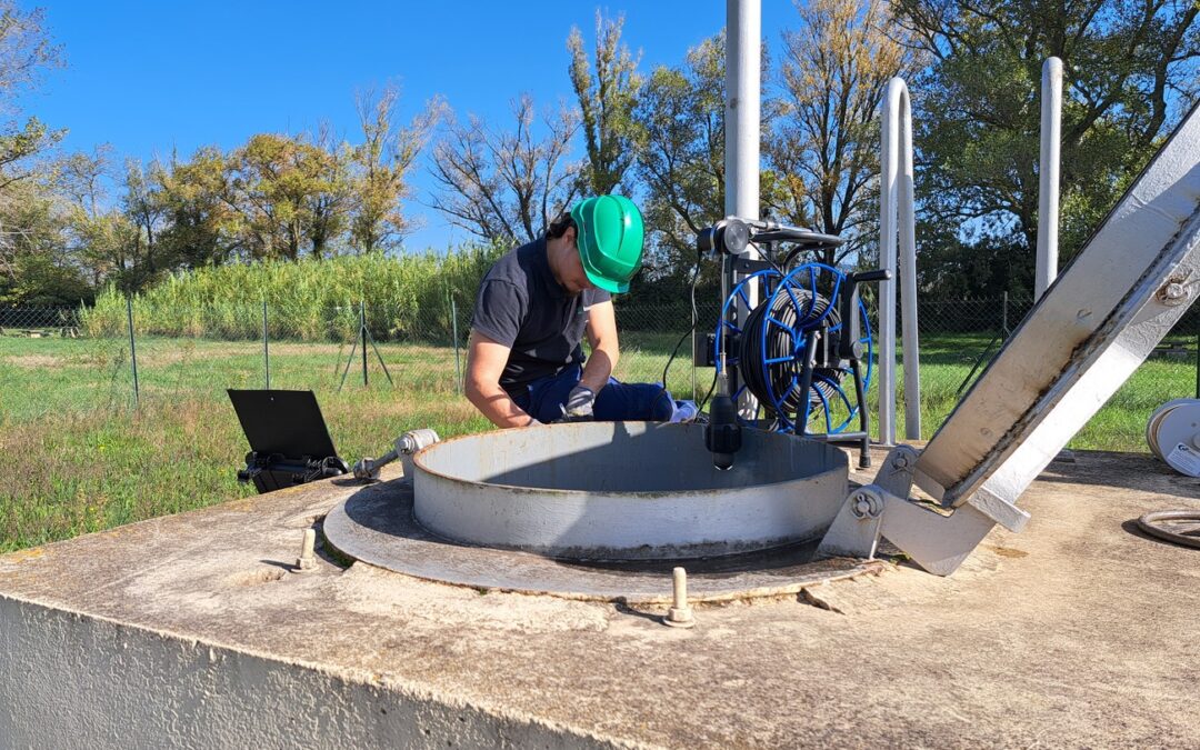
Several systems for continuously monitoring the conductivity of the water over its entire height were deployed on barges in the middle of the river. This high-frequency vertical and temporal data will make it possible to detect the arrival of chloride plumes and serve as an alert and management aid for the dam and locks, by validating or identifying management practices.
Assets :
3 SMD probes

The Imageau solution
Decision-making tools
Innovative real-time continuous salinity measurement tools are used to help :
- Controlling lockages at the dam;
- Decide whether to restrict certain uses if the resource is threatened;
- Optimising the management of water resources for different uses.
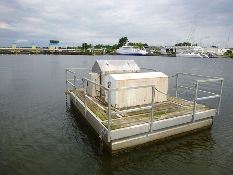
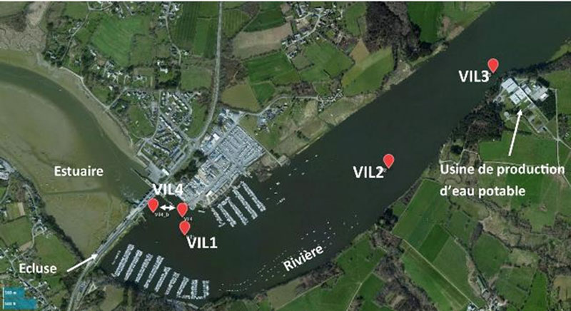
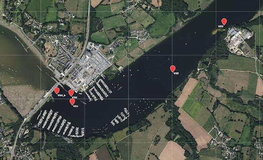
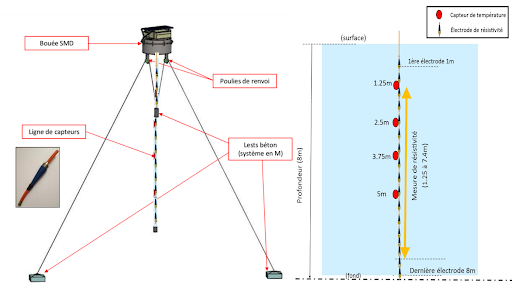
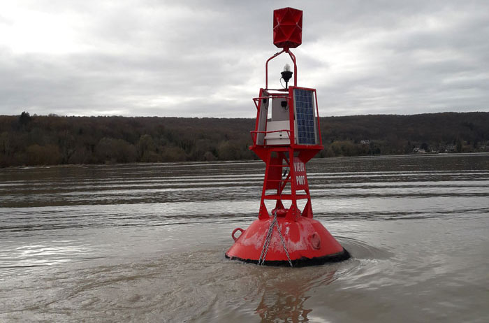
Position of continuous water conductivity measurement systems (SMD) on barge
Solutions for measuring water salinity
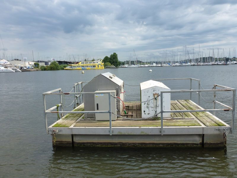
For this high-frequency temporal and spatial monitoring, three multi-probe water conductivity monitoring systems (SMD) have been installed on barges on the river. These robust, autonomous systems measure water conductivity at different depths in the river at three different locations. Thanks to their high-frequency measurement over time, the river’s conductivity can be monitored almost continuously.
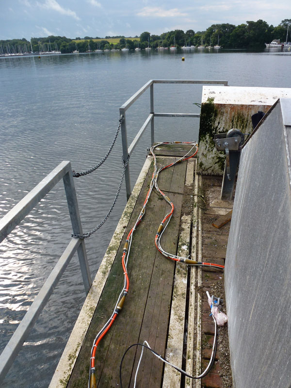
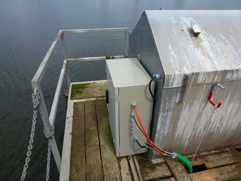
Continuous conductivity measurement system on a barge
Findings from water conductivity monitoring
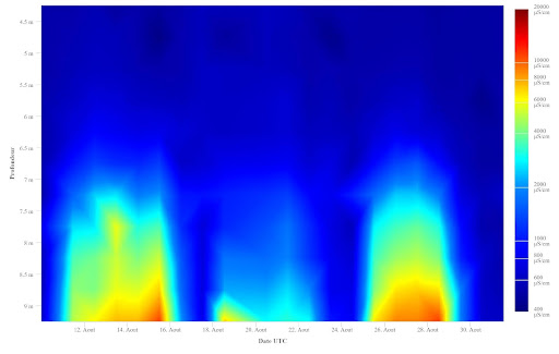
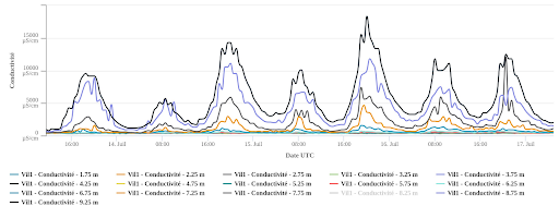
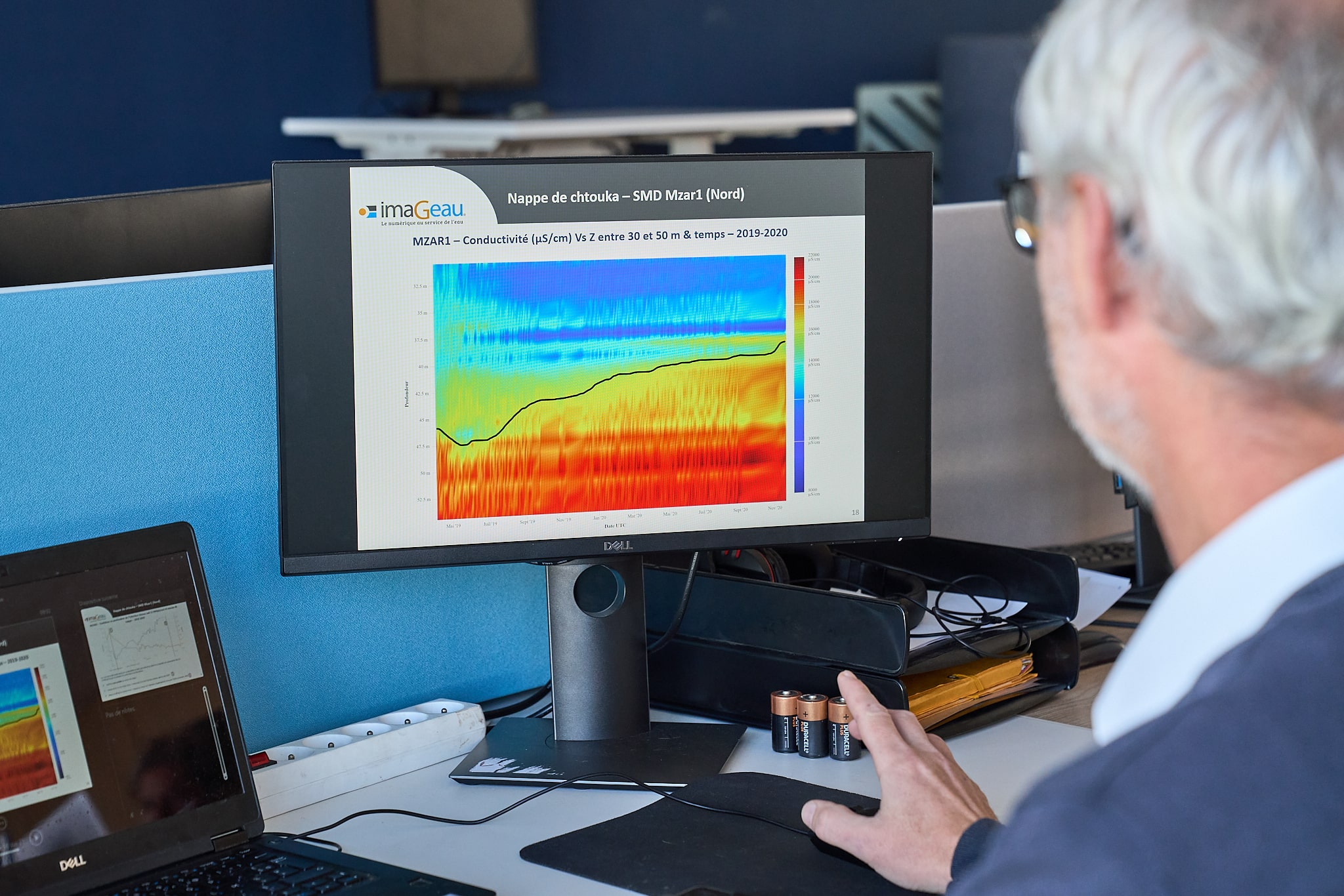
The vertical conductivity profiles measured continuously reveal a vertical gradient in conductivity that changes very rapidly depending on the season and the days when the lock is closed, with a sudden drop in conductivity at all levels.
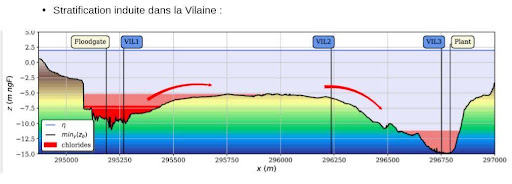
Diagram of chloride dynamics from the lock/dam to the downstream pumping station
The spatial distribution of the multi-level measurements makes it possible to follow the movement of the salt water plume, at the bottom of the water body, between 6 and 8 m deep, migrating further upstream towards the plant. Low-frequency (summer/winter) and high-frequency (of the order of 2/3 days) dynamics are recorded, making it possible to monitor the dynamic evolution of chlorides, particularly towards the raw water pumping station where the chlorides fill the pit facing the plant from the bottom.
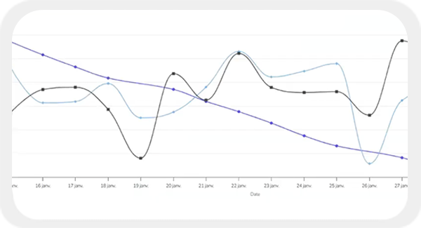
Change in conductivity as a function of depth (ordinate) and date (abscissa) in September 2017 measured by the SMD near the lock
Conductivity curves measured by the SMD near the lock at different depths over 2 days in summer 2017
Benefits and costs avoided by monitoring the salt front
- Alert to the presence of a plume and its migration towards the plant’s catchment area:
- Control action: decision to restrict lockages. These decisions are not without consequence, as they have a real economic impact on pleasure boating on the river, and therefore significant regional consequences.
- Alert on the evolution of the presence of chlorides as close as possible to the operation:
- Operational action: decision to limit pumping during these periods in order to avoid the presence of chlorides in the station’s raw water (thus limiting treatment and the corrosive impact of salt water on pipes).
Project co-authors
Denis Neyens
As the originator of the development of hydro-geophysical probes (SMD, Patent FR2993055A1- (2012)) and as a manager of innovative projects, I attach particular importance to integrating a multidisciplinary, multi-scale approach into my projects, based on cross-referencing complementary data (geophysical, hydrogeological, geochemical, etc.).
My expertise is based on over fifteen years’ experience of analysing and interpreting data in order to provide innovative solutions for managing groundwater, particularly in coastal areas affected by saline intrusions.
I’m in charge of European scientific projects within imaGeau, and I’m currently developing collaborative projects (private/public) on groundwater recharge solutions to limit the impact of droughts and the advance of saline intrusions.
Are you a local authority or an operator affected by rising salt water?
 Testimonial from EPTB Vilaine
“Having a decision-making tool (through monitoring) that allows restrictions to be decided only as a last resort is of real benefit”.
During the summer, this monitoring enables us to be vigilant about the intrusion of chlorides via the lock and their migration towards the drinking water plant. By making it possible to capitalise on the data, the stations constitute a tool for knowledge and understanding of this phenomenon. They also make it possible to anticipate chloride peaks during periods of drought.
Based on the data, decisions to restrict lockage are supported and are only taken when risk phenomena are identified by the monitoring. Lock closures have a direct economic impact on recreational boating and local activities. Having a decision-making tool (through monitoring) that allows restrictions to be decided only as a last resort is of real interest.
This monitoring would eventually make it possible to control an operational ‘anti-salinity’ system (pumping) of chlorides, when this is installed in the lock.
The project in pictures
