In hydrogeology, the importance of the piezometer cannot be underestimated, as it plays a crucial role in understanding the behaviour of water tables. This tool is fundamental to establishing sustainable water management that meets current and future environmental challenges.
In this article, we explore the role of piezometers, how they work, and their usefulness in understanding and protecting aquifer resources.
What is piezometry?
Piezometry is a measurement used to assess water pressure in underground aquifers. This technique measures the height of the groundwater surface, either in relation to a reference point on the ground, or in relation to sea level.
This measurement is essential for understanding the behaviour of aquifers. It allows hydrogeologists to examine the response of groundwater to natural and man-made factors.
For example, it helps to identify how the operation of a well can influence the water level in an aquifer. This understanding is vital for the sustainable management of water resources, particularly to prevent conflicts of use and the overexploitation of aquifers.
Focus on the piezometer
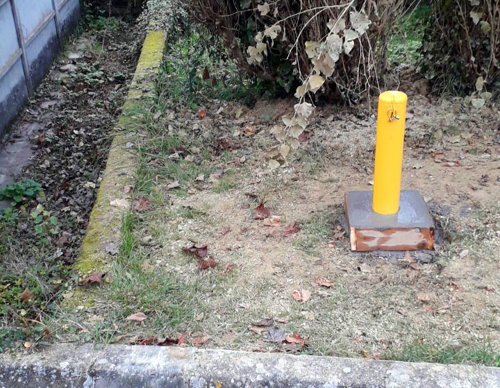
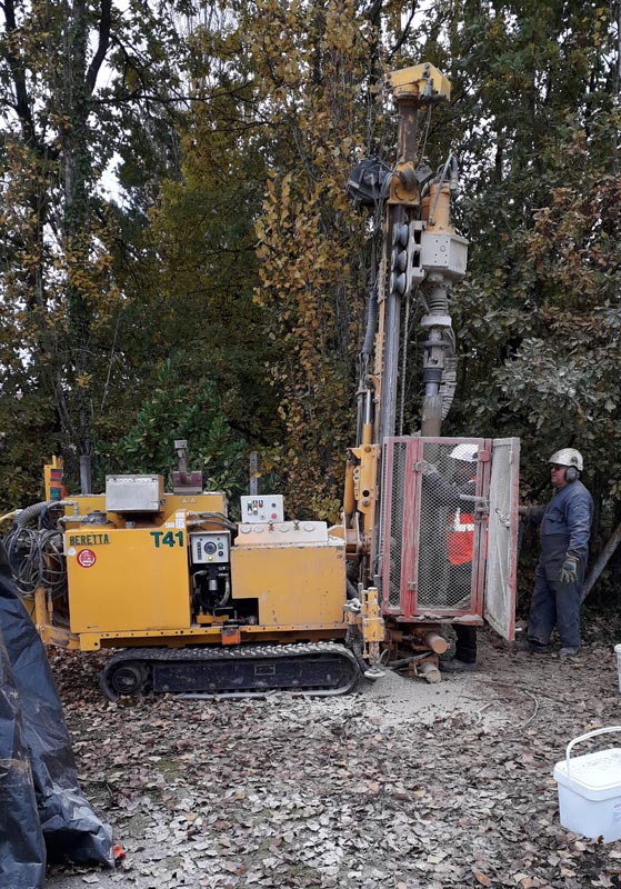
A piezometer is essentially a borehole designed for monitoring groundwater, not for exploitation. Its main function is to measure the groundwater level at a specific point in the water table.
The device may take the form of a tube or a well, through which hydrogeological engineers can access the groundwater to measure the piezometric height.
The different types of piezometer
The types of piezometers encountered are generally wells or boreholes used as piezometers, small-diameter structures designed specifically for taking measurements, and so-called “panpipes”. The latter make it possible to detect several distinct depths within a single borehole.
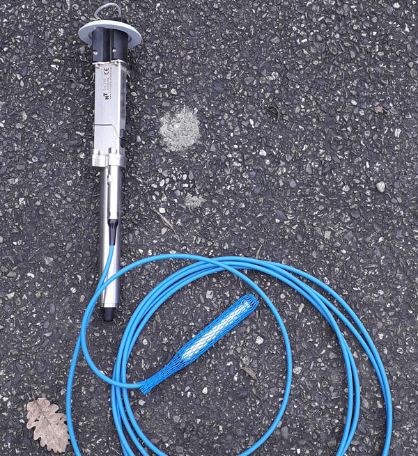
There are also piezometers fitted with pressure sensors, which provide more accurate measurements and can be used for continuous monitoring. These have the advantage of automatic recording and remote access.
Finally, the term piezometer can also be used to designate other structures, such as wells, boreholes or gravel pits. What they all have in common is that they provide access to an underground water resource.
Piezometric measurement methods
By probe
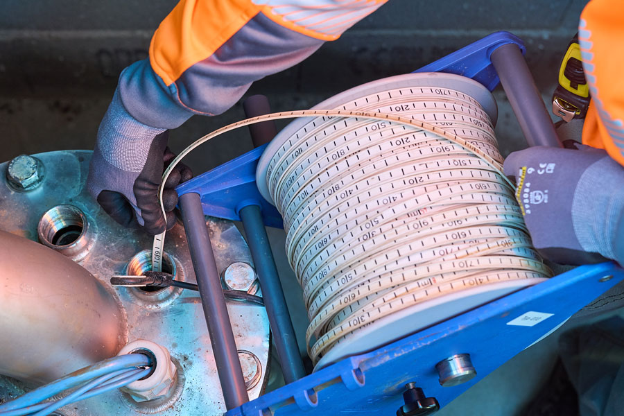
Measuring piezometric levels is a delicate procedure, requiring a high degree of accuracy and reliability. The most basic technique involves the use of a manual piezometric probe, often used for spot measurements.
This simple but effective approach involves measuring the height of the water using a differential pressure sensor. It is useful for instantaneous assessments or periodic checks, but only captures the situation of the water table at a point in time.
By remote transmission
The piezometer is fitted with an automatic recorder (sensors, float system) that allows the information collected by the equipment to be retrieved remotely. The advantages are numerous: it facilitates real-time monitoring, reduces the need for field visits, and provides a complete and dynamic picture of changes within the aquifer.
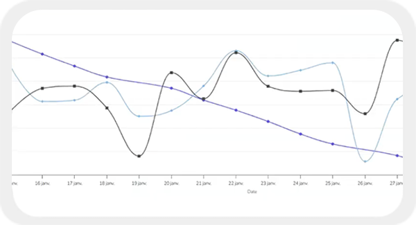
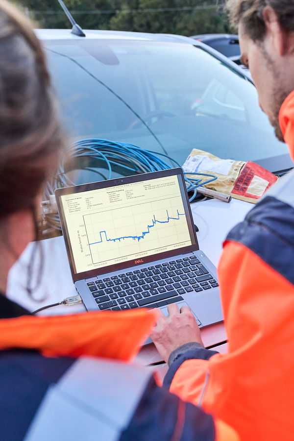
Thanks to automatic sensors and remote transmission, it is possible to monitor fluctuations in water levels in real time, providing a more in-depth understanding of hydrological cycles and the impact of human activities on groundwater.
In addition, remote transmission facilitates the integration of piezometry data into information systems, making the analysis and management of water resources simpler and more effective on a day-to-day basis.
Piezometry in practice
The piezometric measurement process follows precise steps to ensure the accuracy and reliability of the data:
- Selection of an appropriate location to ensure an accurate representation of the water table under study.
- Installation of the piezometer.
- If measuring manually: immerse the probe in the piezometer until it reaches the water, then read the data on the probe’s graduated scale.
- Remote transmission: calibration and installation of the sensors to record the data continuously, with subsequent processing and analysis of the information directly in a dedicated application.
In both cases, the measurement is taken from a benchmark, a reference point from which all water level measurements are taken.
The consistency and accuracy of this benchmark is very important, as it ensures that the information gathered over time is comparable and reliable. This is essential for monitoring long-term trends and changes in groundwater levels.
Recommendations and standards for piezometers
The creation and operation of piezometers requires special precautions, and here are some recommendations:
- Official declaration: it is subject to heading 1.1.1.0 of the IOTA nomenclature, which requires prior declaration to the government departments at least two months before the work begins.
- Qualification of operators: it is advisable to use qualified or certified companies and sounders to ensure that the installation is carried out according to the rules of the trade.
Imageau can advise and support you in setting up and declaring your piezometers.
The role of the piezometer
Monitoring groundwater levels
This is one of its most important applications.
By providing continuous data on groundwater levels, it enables hydrogeologists and water resource managers to detect important trends. These include drops in water levels due to over-extraction or increases resulting from heavy rainfall.
This information is essential for the sustainable management of groundwater resources, as it helps to prevent over-exploitation and proactively plan water conservation strategies.
Measuring water quality
Piezometers also play a crucial role in assessing groundwater quality. They allow regular water sampling to analyse various physico-chemical parameters, such as :
- Conductivity
- pH levels
- The presence of heavy metals (aluminium, zinc, copper, lead, etc.), hydrocarbons, radioelements and other contaminants.
Hydrogeologists are therefore able to monitor the impact of human activities on groundwater and detect any pollution. These analyses can also be carried out to assess the presence of micro-organisms or bio-contaminants, providing a complete picture of the health of the aquifer.
Production of piezometric maps
Piezometry can also be used to create piezometric maps, which represent the underground surface of water tables and are essential for understanding the hydrological behaviour of an aquifer or a particular water table.
They have a wide range of uses, but here are just a few of them:
- Understanding the direction and speed of groundwater flow,
- Studying the structure of the aquifer and assessing its capacity
- To understand the spatial distribution of water stocks and drainage routes
- Check whether the water table has been disturbed by pumping
- Identify aquifer recharge and discharge zones
- Identify areas suitable for water catchment.
These maps provide invaluable information for rational water management, as well as flood prevention and protection against pollution.
They are produced by means of piezometric campaigns carried out on boreholes.
Maintenance and inspection of piezometers
Regular inspection of piezometers is essential to ensure that they are working properly and that the data they supply is accurate. This includes checking the physical integrity of the piezometer, the correct condition of the sensors and measuring instruments, and the absence of obstructions or damage that could affect these measurements.
Imageau helps you manage your piezometers
ImaGeau is a multi-award-winning hydrogeology consultancy that designs and develops digital water resource management solutions for local authorities and industry.
Find out more about our piezometer-related services:
EMI, an application designed to simplify the management of your water resources and catchments
- Equip and connect your piezometers to centralise data from your observation stations
- Connection of Open Data of interest to you: Piezometry, hydrometry, weather stations, etc.
- Daily interpretation of your raw data, transformed into decision-support indicators.
The hydrogeological consultancy, at your side for optimised and responsible water management
- Support and advice for the creation and management of piezometers
- Carrying out piezometric campaigns
- Drawing up, monitoring and updating your regulatory files (application for authorisation, declaration of piezometers, etc.)
